The Skellig Ring
Portmagee · Valentia · Ballinskelligs
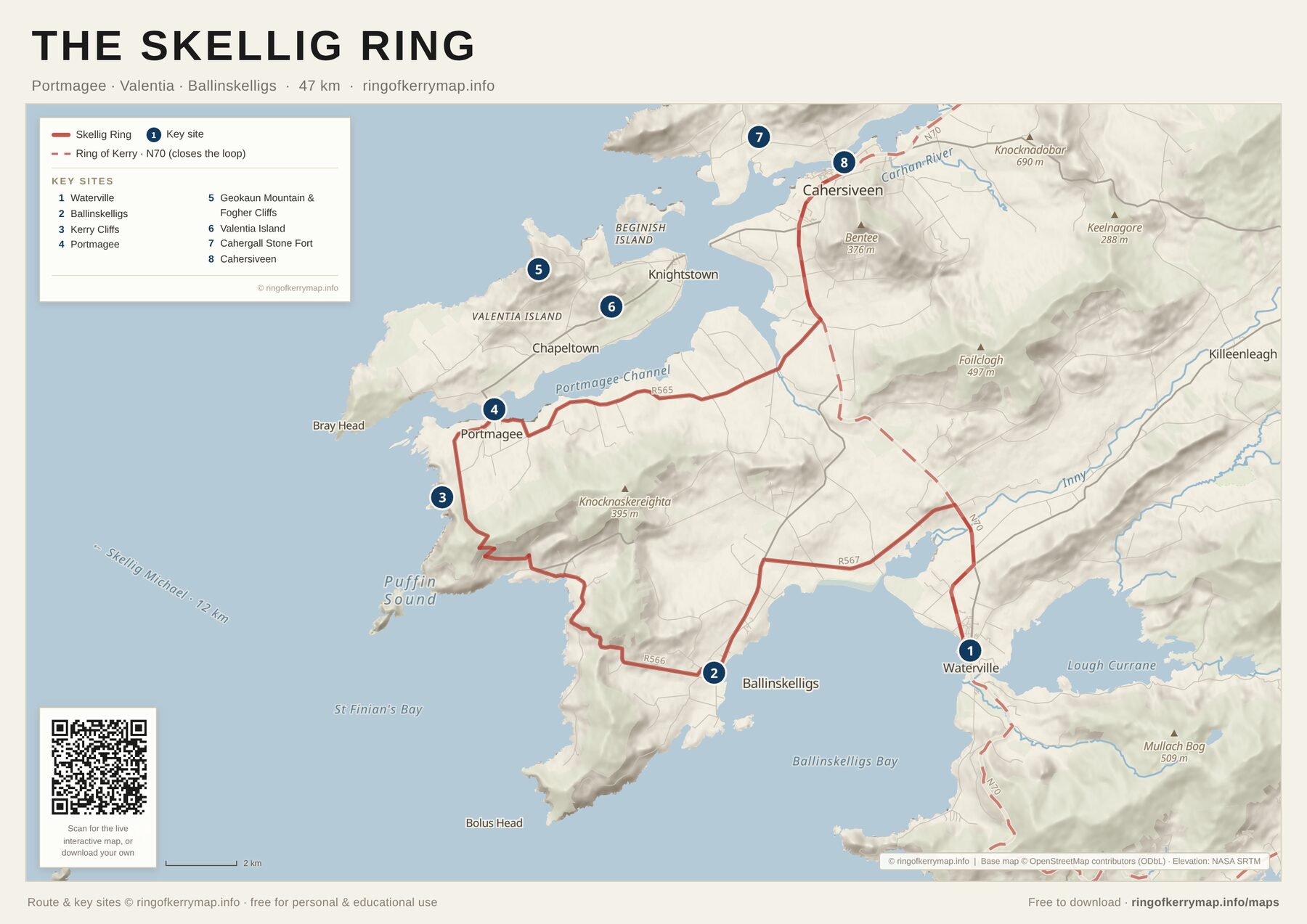
A zoom-in on the wild western detour most tour buses miss - the Skellig Ring, looping through Portmagee, Valentia Island and Ballinskelligs, with the Skellig Michael viewpoints along the coast.
A4 · PDF · 393 KB
Download this map (PDF)What’s on this map
- The Skellig Ring detour off the main loop
- Valentia Island, Portmagee and the Kerry Cliffs
- Geokaun Mountain, Cromwell Point and Ballinskelligs
- The Atlantic coastline facing the Skellig islands
Licence
Free for personal and educational use - please keep the attribution intact. Not for resale or commercial redistribution. Route and key sites © ringofkerrymap.info; map data © OpenStreetMap contributors (ODbL); elevation data NASA SRTM.