South Kerry Greenway
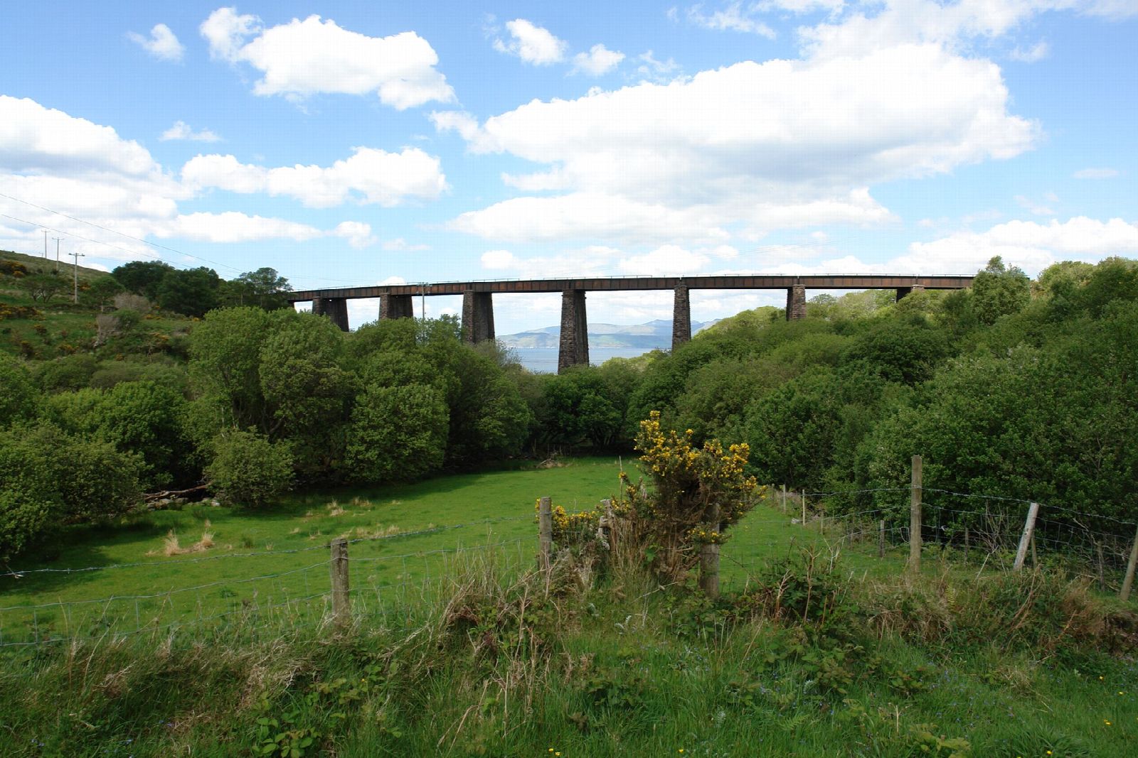
The old Valentia Harbour railway, reopening as a walking and cycling route along the Ring's western arm. Two sections are walkable so far, at Glenbeigh and at Kells, where the railway's easy gradient carries you along the seaward side of the hill with Dingle Bay spread out below and no traffic at all.
From the 1890s until 1960, the most westerly railway in Europe ran along the southern shore of Dingle Bay, carrying Great Southern and Western Railway trains out to Valentia Harbour. The South Kerry Greenway is that alignment coming back into use, this time for walkers and cyclists. Its appeal is really a matter of geometry: a railway had to hold a gentle gradient, so it took the seaward side of the hill and stayed there. You get the views the N70 never gets, without the climbs and without the coaches.
Two sections are open, and they do not yet join up. The longer runs about 6 km from Glenbeigh south west to Kilkeehagh, out past Mountain Stage, and it arrived in two goes: 4.2 km opened on 2 April 2026, then a further 2.2 km on 29 May. It takes in a bridge and two boardwalks, the second a 100 m elevated stretch with the country opening out on either side. Only about 4.5 km of it is the old railway. The rest is what the council calls quiet road: two short shared stretches where you walk or cycle on the same surface as cars, signed as such. The shorter is about 3 km at Kells, open since just before Christmas 2025 and the first piece of the route walkable at all. Between them lies around 8 km of alignment still to be built, so for now each section is an out and back rather than a through route. Both are sealed and level enough for buggies and ordinary bikes.
It took a long time to get even this far. The greenway spent years in the courts, where objectors challenged the planning permission and the compulsory purchase of land along the route. The Supreme Court refused leave for a final appeal in February 2022, and construction followed. When the whole thing is finished it will run about 27 km from Glenbeigh to Cahersiveen, and Kerry County Council has since consulted on a further 1.3 km at Cloghanelinaghan above the Cahersiveen estuary.
One thing worth knowing before you go: the spectacular engineering is not on the open sections. The Gleensk viaduct, pictured above, strides across its valley on a stretch that is still closed, as are the tunnels cut through the flank of Drung Hill. What you can walk today is the quieter pleasure of a well graded path above the sea, which on a clear day is more than enough. There is a marked trailhead car park at the Glenbeigh end and parking near the path at Kells. The Glenbeigh section is about 6 km each way, so allow around three hours to walk it out and back, or under an hour on a bike. Kells Bay Gardens is a few minutes away by car if you want to make a morning of it, and Rossbeigh Beach is just the other side of Glenbeigh.